- WEATHER
Australia
- National
- New South Wales
- Victoria
- Queensland
- Western Australia
- South Australia
- Tasmania
- ACT
- Northern Territory
Long Range Forecasts
- WARNINGS
- RADAR
- SATELLITE
- MAPS & CHARTS
- LONG RANGE
Long Range Forecasts
- CLIMATE
Climate Indicators
- NEWS
Maleny Forecast Meteograms
About Weatherzone Meteograms
Meteograms are a means of displaying a computer model forecast for a certain point within the domain over which the model runs. They compliment charts which show output over the whole domain (or part of the domain) for one time step.
Roll over the vertices on the meteograms with your mouse to see numeric values.

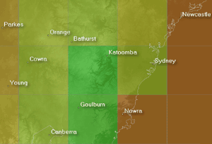
The GFS model output comes at a resolution of 1° meaning many places with relatively different climates may lie within the same grid cell.
A computer model operates by dividing the atmosphere into grid cells which may be quite large so it's important to factor the spatial resolution of the model into your interpretation of the output (see below).
In addition, different models output data for different time steps. Using a model with an output time interval of 6 hours a temperature of 20° at analysis time and a predicted temperature of 15° six hours later will be displayed with a line between the two but of course there may be fluctuations between those times (a spike to 25°, for example) which will not be reflected.
A meteogram shows the general nature of what may be experienced within the area in which the point lies, over time. Some local knowlegde (the likely effects of elevation and terrain in a certain weather pattern, for example) will help you refine this guidance.
See the weather glossary for definitions of terms used on this page.
About ACCESS Global
(definition not available)
Eastern soaking underway with two months' rain in western NSW
12:37 AEST Parts of Western NSW, Qld and Vic have seen double their average May rainfall in the last 24 hours, with rainfall set to continue Friday before focusing on the east on the weekend. The rain is being generated by an upper level trough which is sitting over the region, which is expected to move east over the weekend. These are the largest falls recorded during the 24 hours to 9am on Friday, May 10; Noona in NSW observed 54mm, taking the monthly total to 89.8mm after 32mm fell during last week's event. White Cliffs saw double the May monthly rainfall average in a day with 44m, the most daily rain in May in 43 years. Broken Hill, NSW and Thargomindah, Qld also saw more than a month's worth of rain, with 23.8mm and 26.2mm falling respectively. Mangalore airport, Vic recorded 41.4mm, making it the wettest May day in 24 years. Wilcannia, NSW observed 39.8mm, its biggest daily May rainfall in 21 years The opening nine days of May have been very wet for much of NSW and southeast Qld.
- 20:44 AEST Severe thunderstorms to hit WA on Friday
- 15:04 AEST Record-breaking global atmospheric moisture in April
- 12:58 AEST Freezing ocean temps cold comfort for South Australians
- 16:46 AEST More rain for thirsty southwest WA
