- WEATHER
Australia
- National
- New South Wales
- Victoria
- Queensland
- Western Australia
- South Australia
- Tasmania
- ACT
- Northern Territory
Long Range Forecasts
- WARNINGS
- RADAR
- SATELLITE
- MAPS & CHARTS
- LONG RANGE
Long Range Forecasts
- CLIMATE
Climate Indicators
- NEWS
Marine Weather
Central West Marine Weather Overview
 |
Swell height | Districts with warnings | 3pm forecast wind |
 navigate by marine district
Derwent Estuary
Hobart Waters
Inland Waters
Far Northwest
Central North
Northeast
Banks Strait
Upper East
Lower East
Southeast
Southwest
Central West
 most recent warnings
TAS - Mon 05:00 ESTStrong Wind Warning Banks St & Franklin Sound, East of Flinders Is & Far NW, CN & Upper E Coasts. Cancelled Storm & Lower E & CW coasts
View all current warnings
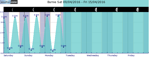
tides for Burnie
 forecast
Southeasterly 15/20 knots, reaching up to 25 knots during the morning. Winds turning northeasterly 10/15 knots in the evening. Seas: 1/2 metres, decreasing to 1/1.5 metres during the afternoon. Swell: Southwesterly 2.5/3 metres. Outlook Tuesday: North to northeasterly 15/25 knots, reaching up to 30 knots offshore during the morning and early afternoon. Seas: Around 1 metre, increasing to 1.5/2.5 metres during the morning. Swell: Southwesterly 2/2.5 metres. Outlook Wednesday: Northwest to northeasterly 15/25 knots becoming variable about 10 knots during the evening. Seas: 1/2 metres, decreasing to 1/1.5 metres during the afternoon or evening. Swell: Southwesterly 2/2.5 metres.
Issued Mon 05:00 ESTSeas: Up to 2.0m
Swell: Up to 3.0m, SW
forecast winds
Monday: SE 25 ktsTuesday: N/NE 30 kts
Wednesday: NW/NE 15/25 kts
- locations
- Strahan
Sun & Moon Times
| first light | sunrise | sunset | last light | moon set | moon rise | moon phase | last quarter | new moon | first quarter | full moon |
|---|---|---|---|---|---|---|---|---|---|---|
|
06:20 EST |
06:48 EST |
17:50 EST |
18:18 EST |
07:50 EST |
18:03 EST |
|
Apr 21 |
Apr 28 |
May 4 |
May 13 |
Boomerang Errol: tropical system could have Kimberley homecoming
16:39 AEST A tropical low which developed over the Timor Sea late last week is forecast to intensify into Tropical Cyclone Errol tomorrow, Monday 14th.
- 10:39 AEST 'Pink moon' to illuminate Australia this weekend
- 13:04 AEST Tropical cyclone to form near WA
- 11:17 AEST Mid-autumn hot spell for Melbourne, Adelaide
- 12:03 AEST High chance of tropical cyclone near Australia next week


