- WEATHER
Australia
- National
- New South Wales
- Victoria
- Queensland
- Western Australia
- South Australia
- Tasmania
- ACT
- Northern Territory
Long Range Forecasts
- WARNINGS
- RADAR
- SATELLITE
- MAPS & CHARTS
- LONG RANGE
Long Range Forecasts
- CLIMATE
Climate Indicators
- NEWS
Marine Weather
Central North Marine Weather Overview
 navigate by marine district
Derwent Estuary
Hobart Waters
Inland Waters
Far Northwest
Central North
Northeast
Banks Strait
Upper East
Lower East
Southeast
Southwest
Central West
 most recent warnings
TAS - Sun 22:00 ESTGale Warning Lower E, SE & SW coasts. Strong Wind Warning Banks St & Franklin Sound, East of Flinders Is & Far NW, CN, Upper E & CW coasts
View all current warnings
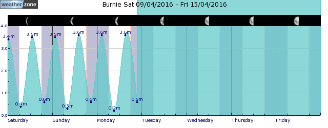
tides for Burnie
tides for Launceston
 forecast
Westerly 25/30 knots turning southwesterly 20/30 knots during the morning. Seas: 2/3 metres. Swell: Westerly 1/2 metres, decreasing to 1/1.5 metres around midday. Outlook Tuesday: Southwesterly 15/20 knots turning westerly 10/15 knots in the late morning. Seas: Around 1 metre, increasing to 1/1.5 metres offshore. Swell: Westerly 1/1.5 metres, decreasing to around 1 metre during the morning. Outlook Wednesday: Westerly 10/15 knots becoming variable about 10 knots during the afternoon. Seas: Below 1 metre. Swell: Westerly below 1 metre.
Issued Sun 22:00 ESTSeas: Up to 3.0m
Swell: Up to 2.0m, W
forecast winds
Monday: W 25/30 ktsTuesday: SW 15/20 kts
Wednesday: W 10/15 kts
- locations
- Low Head
- Bridport
- Scottsdale
- Wynyard
- Burnie
- Devonport
- Launceston
Sun & Moon Times
| first light | sunrise | sunset | last light | moon rise | moon set | moon phase | full moon | last quarter | new moon | first quarter |
|---|---|---|---|---|---|---|---|---|---|---|
|
06:08 EST |
06:35 EST |
17:57 EST |
18:25 EST |
15:35 EST |
01:30 EST |
|
Apr 13 |
Apr 21 |
Apr 28 |
May 4 |
Enter a postcode or town name for local weather, or text to search the site. » advanced search
27 days of rain: Townsville's longest run of recorded rain days in over three decades
15:25 AEST A few days ago, we explored why Queensland has been so drenched this March, with the state experiencing its third-wettest March on record.


